
Mineral maps, in the field.
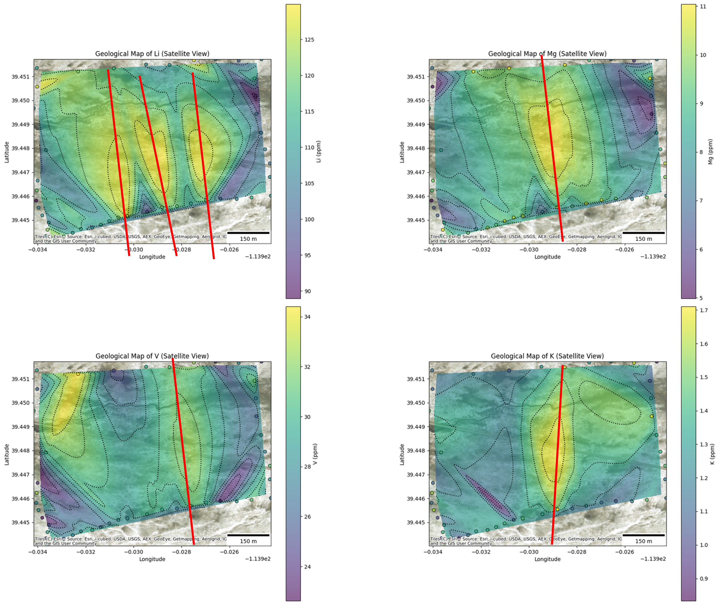
High-resolution contour maps for all elements that develop with each measurement and can be interpreted in the field by geologists.
Ranked targets built from the full geochemical picture that geologists use to build test-drilling plans while on site.
Full grid coverage: do it once, know it now.
VALIDATION — OPERATIONAL, UTAH
Instant results. 90% test-drilling cost savings.
In Utah, BEAM completed a two-week lithium survey that produced new geochemical intelligence while the programme was still underway. BEAM increased confidence in the geological model by 3.5x.
$300M → $1bn
Expected deposit value after the survey, versus $500M assumed before it
2 holes
Planned instead of up to 30 with a traditional survey
<$1M
Cost to confirm by test drilling, versus up to $10M traditionally
Real time
High-resolution maps generated in the field, during the programme
““We are getting the data, finding the anomalies, and staking claims all at the same time… this is changing the exploration game.””